Mount Fansipan, towering at 3147 meters (1909 measurements gave it an altitude of 3,143 m), majestically reigns over Indochina from the far reaches of northwestern Vietnam. This sentinel of the Hoang Lien Son mountains, located just a few kilometers from Sapa, is the ultimate southeastern extension of the Himalayan range.
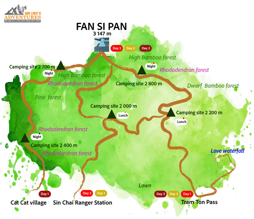
Three routes are available to adventurers
A very rich biodiversity
A favorite challenge for experienced hikers, the ascent of Phan Xi Păng offers an immersion into an ecosystem of exceptional richness, with over 1700 plant species, some of which are endangered. The mountain is divided into three distinct zones: a lush tropical jungle up to 700 meters, a semi-temperate zone up to 2800 meters where majestic fokienia thrive, and finally a temperate zone dominated by conifers.
The ideal season for climbing Fansipan
Spring, particularly March, provides optimal conditions for the climb with its mild temperatures and dry climate. Checking the weather forecast is crucial, as conditions can quickly deteriorate with negative temperatures and slippery trails.
Weather forecasts are crucial
Never underestimate the mountain. Weather conditions can be changeable and extreme, especially at high altitudes. Stay informed about the forecasts and adjust your itinerary accordingly. It's better to postpone a trip than to put yourself in danger.
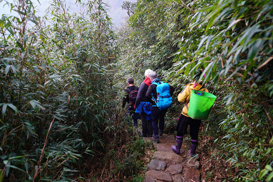
The ascent of Fansipan offers an immersion into high Bamboo Forests - Source : Mr Linh's Adventure
How to get to Mount Fansipan from Hanoi
From Hanoi, Sapa is accessible in 4-5 hours via the highway. Foreign hikers need to obtain a climbing permit and pay various fees at the Ecotourism Center (usually arranged by your hotel or local travel agency). A local guide, usually H'mong, is essential for the ascent.
Preparing your backpack for the adventure
The equipment must be carefully chosen: sturdy hiking shoes, clothing adaptable to temperature changes, camping gear for multi-day ascents. Good physical condition is essential, even if the chosen route is not the most technical.
✓ Shoes and feet: Good hiking shoes with excellent traction, two pairs of socks (one warm for the night), lightweight sandals.
✓ Clothing: Lightweight and breathable clothing, warm sweater, hat, gloves, scarf (if needed), rain poncho, survival blanket.
✓ Protection: Sunscreen, mosquito repellent.
✓ Health and comfort: First aid kit (medications, bandages), toiletries, microfiber towel.
✓ Food: Energy food (bars, dried fruits), water, waterproof bags for electronic devices.
✓ Night equipment: Sleeping bag, mattress, headlamp, toilet paper.
Remember: Adapt this list according to the duration of your hike, the forecasted weather, and your personal needs.
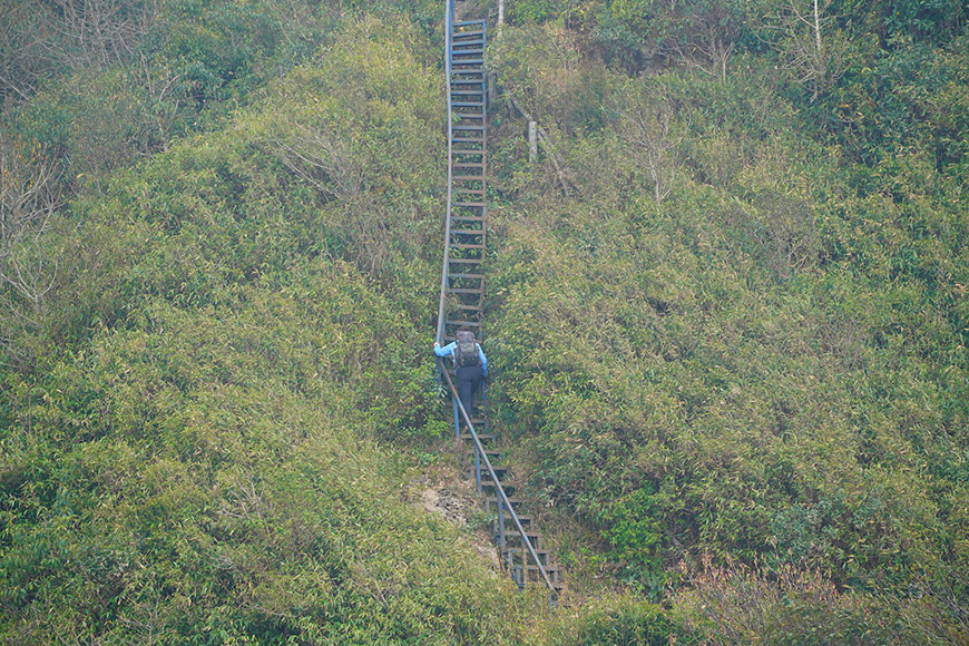
Good physical condition is essential to climb the Roof of Indochina - Source : Mr Linh's Adventure
How to conquer the roof of Vietnam?
Three routes are available to adventurers. The Tram Ton trail, ideal for beginners, offers a gradual ascent over 11 km. The Sin Chai route, shorter but technical, will satisfy experienced hikers. The Cat Cat route, the longest at 20 km, rewards walkers with exceptional panoramas.
Technical sheets of the routes
Tram Ton route (2 days / 1 night)
✓ Distance: 11 kilometers
✓ Elevation gain: 1300 meters (starting at 1850m)
✓ Difficulty: Moderate
✓ Camps: Base (2200m) and altitude (2800m)
✓ Average time: 6-7 hours ascent, 5-6 hours descent
✓ Characteristics: Marked trail, steady progress, accommodation infrastructure
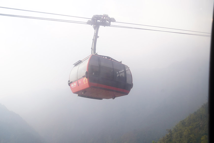
You can go back by cable-car - Source : Mr Linh's Adventure
Sin Chai route (2-3 days)
✓ Distance: 9 kilometers
✓ Elevation gain: 1770 meters (starting at 1380m)
✓ Difficulty: Challenging to very difficult
✓ Characteristics: Technical terrain, dense vegetation, steep sections
✓ Public: Experienced hikers only
✓ Specific equipment required
Cat Cat route (3-4 days)
✓ Distance: 20 kilometers
✓ Elevation gain: 1850 meters (starting at 1300m)
✓ Difficulty: Challenging
✓ Characteristics: Long route, exceptional panoramic views
✓ Some bivouac points
✓ Total immersion in the local environment
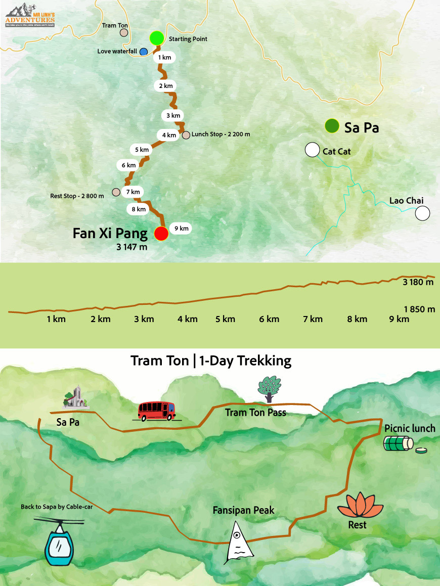 Focus on the Tram Ton Trail
Focus on the ascent via Tram Ton
The Tram Ton route, the most accessible, is divided into four strategic sections.
First section: Tram Ton (1850m) - Base Camp (2200m)
The trail gradually ascends through a dense forest. This relatively easy part allows for a good warm-up. Streams and shaded areas mark the progress. Estimated time: 2-3 hours.
Second section: Base Camp - Altitude Camp (2800m)
The route becomes more technical with a series of steep climbs. Panoramic views open up to the surrounding valleys, offering spectacular waterfall views. This section requires 3-4 hours of effort. The altitude camp has a water source and basic facilities.
Third section: Altitude Camp - Ridge (2900m)
Demanding passage with a mix of steep climbs and technical traverses. The vegetation thins out, giving way to a more alpine atmosphere. This stretch requires 1-2 hours of sustained climbing.
Final section: Ridge - Summit (3147m)
The last 100 meters are the most challenging. The trail, particularly steep and often slippery, requires constant attention. The reward is complete with a breathtaking view of the surrounding mountain ranges.
Practical tips for Tram Ton
- ♦ An early start (4-5 am) is essential for a one-day ascent. Progress should be steady, with frequent but short breaks. Water is available at the base and altitude camps, but carrying enough is advisable.
- ♦ The return can be done via the same route or, as a popular option, by cable car. The descent on foot requires as much attention as the ascent, especially after high-altitude sections.
- ♦ Spending the night at the altitude camp (2800m) offers a unique experience with spectacular sunsets and total immersion in the mountain atmosphere. The temperature can drop drastically, requiring equipment suitable for alpine conditions.
- ♦ This path represents the ideal compromise between accessibility and sporting challenge, providing a true high mountain experience while remaining within reach of well-prepared hikers.
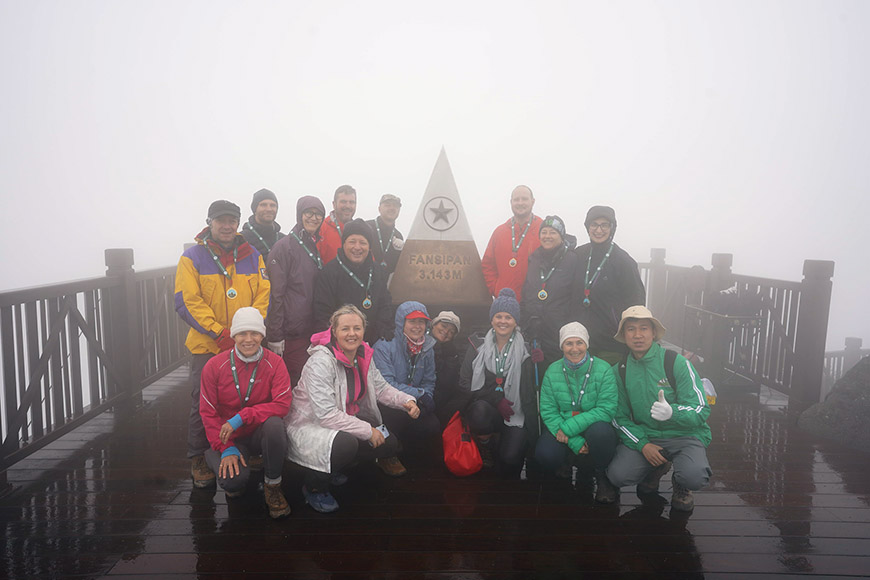
Here we are : at the summit of the Fansipan ! Source : Mr Linh's Adventure
Latest recommendations
For a flawless trekking experience, follow these essential tips
✓ Choose a trail suited to your skill level and physical condition.
✓ Be prepared for physical and mental challenges along the way.
✓Respect safety instructions and follow the advice of your guide or trekking group.
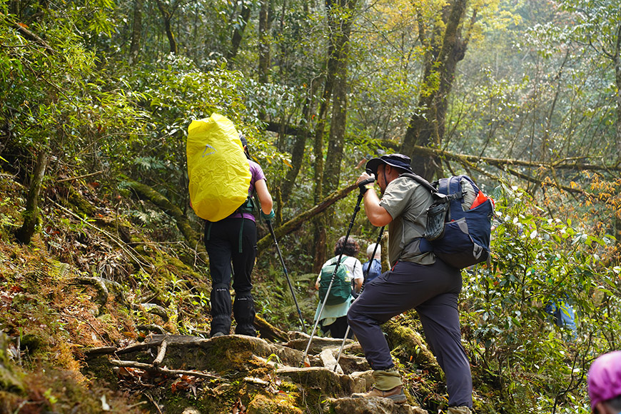
Take up the challenge of the roof of Indochina with Mr Linh's Adventure !
Conclusion: The call of Fansipan
Conquering Fansipan is much more than a simple climb. It's a total immersion in an environment where history, culture and wilderness come together. If the summit is the ultimate goal, the real treasure lies in the vertical journey through the different ecosystems, offering a unique insight into Vietnam's natural heritage.
The choice of route, whether technical like Sin Chai or more accessible like Tram Ton, will determine the nature of your adventure. But all converge towards the same reward: the privilege of contemplating Indochina from its highest point, in perfect communion with the elements.
Climbing this mythical mountain is much more than just a sporting challenge. It's an inner journey, an encounter with oneself, all in an exceptional natural setting that will transport you to the heart of Vietnam.
Take up the challenge of the roof of Indochina and enjoy an unforgettable experience in the heart of Vietnam. A sporting and cultural journey that will leave a lasting impression.